
Top 10 Reasons to Trek to The Upper Mustang Region

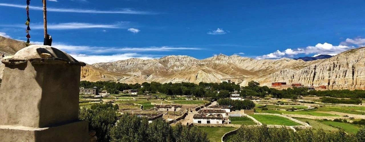
The Upper Mustang trek in Nepal is a unique Himalayan trekking experience through the ancient Kingdom of Lo, known for its red-rock desert landscapes, Tibetan Buddhist heritage, historic cave settlements, and traditional villages near the Tibetan border. Located in the rain shadow of the Annapurna and Dhaulagiri ranges, Upper Mustang offers a striking contrast to Nepal’s greener trekking regions, with eroded sandstone cliffs, deep canyons, centuries-old monasteries, and the walled city of Lo Manthang at 3,840 meters (12,598 feet).
The region’s history as a former Himalayan kingdom and a major route for the traditional salt trade between Tibet and Nepal adds cultural and historical depth to the journey. Trekkers can explore the Chhoser caves, visit ancient monasteries such as Jampa Lhakhang and Thubchen Gompa, experience local Tibetan Buddhist traditions, and discover the fragile trans-Himalayan ecosystem that supports blue sheep, Himalayan wolves, and the elusive snow leopard.
Choosing the right Upper Mustang trekking experience depends on the season, available time, fitness level, and interests. Spring and autumn generally offer favorable trekking conditions, while the region’s rain-shadow climate makes summer an alternative for travelers seeking quieter trails. Itineraries range from multi-day walking treks with high mountain passes and acclimatization stops to shorter jeep journeys, with opportunities to explore Lo Manthang, attend the Tiji Festival, photograph dramatic landscapes, and visit historic settlements along the Kali Gandaki Valley.
Understanding daily walking distances, altitude changes, weather conditions, training requirements, restricted-area permits, and licensed guide regulations helps trekkers prepare for the journey. This guide explores the 10 best reasons to trek to Upper Mustang, providing historical context, cultural highlights, route details, seasonal advice, wildlife insights, and practical planning information to help you decide when to go and how to make the most of your trek.
1. Explore the Ancient Kingdom of Lo in Upper Mustang
The Kingdom of Lo ruled Upper Mustang as an independent state from its founding in 1380 until 1795, when it was annexed into the unified Kingdom of Nepal. It remained an autonomous dependency with its own local monarchy until the Nepali government officially dissolved the kingdom in 2008. The trek covers the territory of a kingdom with more than six centuries of royal rule, and most of its monuments still stand.
What Makes Lo Manthang the Historic Capital of the Kingdom of Lo?
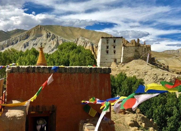
Lo Manthang became the capital because Ame Pal, the warrior who founded the Kingdom of Lo in 1380, built a walled city on the plain of Manthang, a position that controlled the trade route between Tibet and the south.
Manthang translates as "plain of aspiration," and the name Mustang is a mapmaker's corruption of Manthang, according to Mountains of Travel Photos. The original walls rose about 20 feet (6 m). Today the city holds around 180 mud-brick houses, a royal palace, and a monastic quarter with four temples.
Jigme Dorje Palbar Bista (1930 to 2016) was the 25th king in a direct line from Ame Pal, and the last official king of Lo.
Lo Manthang is both the cultural goal and the highest sleeping point of most itineraries. The walled core is compact, so the rest day is the better day to explore it. Walk the outer wall at the start and end of the day, when the light is low and the lanes are quiet.
How Can You Discover Traditional Mustang Architecture and Ancient Settlements?
Mustang architecture combines flat-roofed mud-brick houses, whitewashed walls, red-ochre monastery facades, and carved timber windows, all built to hold heat in a desert where winter nights fall below -10 °C.
Residents stack firewood and dried yak dung on the roofs as winter fuel, so a rooftop tells you how a household prepares for the cold. Sakya monasteries use three wall colors: red, white, and grey, which represent Manjushri, Avalokiteshvara, and Vajrapani.
The settlements along the route each show a different layer. Kagbeni is the gateway village at the permit checkpoint. Ghami has one of the longest mani walls in Nepal. Charang has a fortress and monastery complex. Tsarang has a red monastery and an old fort, about 18 km before Lo Manthang, according to Shikhar Adventure's route notes.
What Historical Stories Make Upper Mustang Unique?
Three stories define Upper Mustang's history: the wealth the Kingdom of Lo earned from the salt trade, the 15th-century Sakya temple building, and the Khampa resistance that used Mustang as a base from the 1960s.
According to Brown University Library's Buddhist Temple Art archive, trade income let the royal house commission the great temples Thubchen and Jampa, and the Tibetologist Giuseppe Tucci was the first modern scholar to view their paintings, in 1952. The same archive records that the Sakya master Ngorchen Kunga Zangpo (1382 to 1456) visited Lo three times at the king's invitation.
The third story explains why the region is restricted. According to the news agency IANS, Tibetan Khampa rebels used Upper Mustang as a base in the 1970s, which led Nepal to close the area to foreigners. A study by Hayley Saul and Emma Waterton at Western Sydney University adds that the guerrilla unit was ultimately abandoned by its American CIA supporters. Many trekkers walk past the old Khampa training stations without knowing it, so ask your guide to point them out.
2. Experience the Rich Tibetan Buddhist Culture of Upper Mustang
Upper Mustang preserves Sakya-school Tibetan Buddhism in its original architecture, language, and ritual calendar. The practice is daily and local, not staged for visitors.
What Tibetan Buddhist Traditions Can You Experience During the Upper Mustang Trek?
You can experience morning monastery prayers, butter-lamp offerings, circumambulation of chortens, masked cham dances, and Sakya liturgy at Lo Manthang's monasteries, along with traces of Bon practice in cave shrines.
The chanting in Thubchen's prayer hall is the most reliable cultural experience on the trek. Time your visit for early morning, when monks gather and the hall is lit by butter lamps.
Etiquette follows Tibetan custom. Pass chortens and mani walls clockwise, keeping them on your right. Spin prayer wheels clockwise. Remove shoes and hats before entering a temple. Photography inside temples is prohibited, and the wall paintings are touched by no one.
The Sakya school's link to Lo is documented. Ngorchen Kunga Zangpo founded Ngor Monastery in Tibet in 1429, and the Jampa temple was built under his instructions, according to the abbot of Lo Manthang quoted by Brown University Library.
How Do Local Festivals, Prayer Flags, and Mani Walls Reflect Mustang's Spiritual Heritage?
Festivals follow the Tibetan lunar calendar, prayer flags carry mantras on the wind, and mani walls hold carved prayer stones, so the trail itself works as a continuous pilgrimage route.
Tiji is the main festival. The lamas of Chode Monastery set its dates each year, and the three days of ritual take place in the royal palace square of Lo Manthang. In 2026 Tiji ran from 14 to 16 May. Day 1 (Tsa Chham) opens with the unrolling of a large thangka of Guru Rinpoche. Day 2 (Nga Chham) shows the deity Dorje Jono battling demons. Day 3 (Rha Chham) ends with the destruction of the demon effigy. According to Mzungu Expeditions, the word Tiji comes from "Tenche," meaning hope for the Buddha's teaching to prevail in all worlds.
The 2027 dates are tentative until Chode Monastery announces them, and one operator lists 1 to 3 June. Confirm before you book flights.
Yartung, a horse festival, takes place in late summer, and Lhosar, the Tibetan New Year, falls in winter. Prayer flags come in five colors, blue, white, red, green, and yellow, each representing an element.
The trade-off with Tiji is crowding. Lo Manthang has limited rooms and no ATMs, so book at least six months ahead and carry Nepali rupees in cash.
How Do Local Communities Preserve Their Tibetan Cultural Identity?
Communities preserve Tibetan identity through the Loke dialect of Tibetan, monastery-led education, restoration of the Jampa and Thubchen murals, amchi herbal medicine, and festivals run by local lamas.
The people of Lo call themselves Lobas, and family-run lodges, horse caravans, and barley farming remain the economic base. Many families move to Pokhara or Kathmandu for the winter and return in spring, so the village you see in May differs from the one in January.
The Mustang Eco Museum in Jomsom shows costumes, instruments, and an herbal medicine section, according to ShowCaves. Visit it on the last day, after the villages have given the exhibits context.
Sleep in family-run lodges, hire local porters, and buy local barley goods, because those payments fund preservation directly.
3. Discover Upper Mustang's Unique Landscapes
Upper Mustang is a red, ochre, and grey desert cut by canyons, and the scenery changes every day of the walk. The color shifts from pale river-bed grey near Kagbeni to deep red cliffs near Dhakmar.
How Do Red Cliffs, Deep Canyons, and Eroded Rock Formations Shape the Landscape?
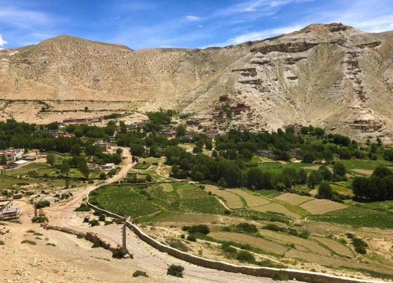
Wind and seasonal water erode soft sediments into red cliffs, narrow canyons, and pillar formations, and the colors shift between morning and evening light along the route from Chele to Dhakmar.
According to archaeologist Prakash Darnal in the HISAN journal, these rocks formed under the ancient Tethys Sea, and the Kali Gandaki still yields shaligram ammonite fossils. Dhakmar (Drakmar) takes its name from the red cliff above the village. The Charang Chu canyon, between Tsarang and Lo Manthang, shows the same erosion at a larger scale.
Wind rises after about 10 a.m. in the valley, so start walking by 7:00 and carry a buff for dust.
Why Is Upper Mustang Known for Its Rain-Shadow Desert Scenery?
Dhaulagiri and Annapurna block the monsoon, so Upper Mustang receives roughly 250 to 400 mm of precipitation a year, which produces a cold desert of bare slopes, irrigated green oases, and clear skies.
A Rufford Foundation project report places the region in the rain shadow of Annapurna with that 250 to 400 mm range. Pokhara, to the south, receives more than 3,000 mm. The contrast explains why the green barley fields of Ghami and Charang exist only where hand-dug channels carry glacial meltwater.
Clear skies carry a cost: ultraviolet exposure rises with altitude, and trekkers above 3,000 m burn quickly.
What Makes the Kali Gandaki Valley Special for Upper Mustang Trekkers?
The Kali Gandaki cuts between the Dhaulagiri (8,167 m) and Annapurna (8,091 m) massifs, and in Upper Mustang it offers a wide, open valley with constant views of Nilgiri (7,061 m).
The river rises on the Tibetan Plateau and drains into the Ganges. The gorge to the south is often ranked among the deepest river gorges on Earth. Upper Mustang's section is gentler, a broad valley where the trail alternates between river bed and terraces.
The river-bed trail between Kagbeni and Chele is flat but exposed to wind, while the terrace trails climb higher and give better views. In monsoon months, high water makes some river-bed sections unsafe, and your guide decides the day's route.
4. Enjoy the Upper Mustang Trek in Different Seasons
Upper Mustang is open year-round, and the rain shadow means monsoon months bring far less rain here than in the rest of Nepal. Each season offers a different trek.
Why Is Spring a Good Time to Trek in Upper Mustang?
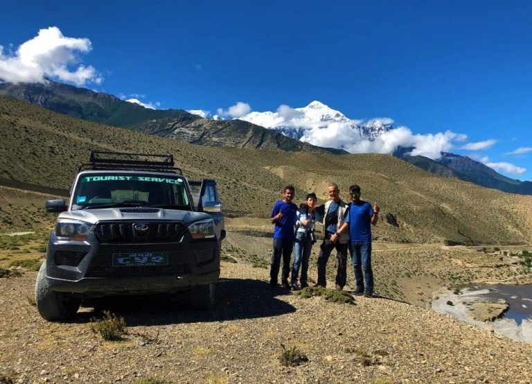
Spring (March to May) suits Upper Mustang because days are warm, skies are clear, lodges reopen after winter, and the Tiji Festival takes place in May in some years.
Snow can remain on Nyi La (4,010 m) and Lo La (3,950 m) in March, so April and May give the most stable passes. Barley is sown in spring, and the fields turn green by late May.
Spring also brings the strongest afternoon winds. Flights from Pokhara to Jomsom run in the morning for this reason, so plan one spare day at the end of the trip.
What Can You Expect During the Summer Monsoon Season?
Summer (June to August) brings green barley fields, daytime highs of about 18 to 25 °C, and light rain in Upper Mustang, while flights and roads south of Jomsom face monsoon delays.
The monsoon affects the approach more than the trek itself. Clouds delay flights on the Pokhara side, and landslides close sections of the road along the Kali Gandaki south of Jomsom. Trails in Upper Mustang stay mostly dry.
A weather buffer in Jomsom or Pokhara costs only lodging, because the Restricted Area Permit charges per day spent inside the restricted area. Fewer trekkers walk in summer, so trails are quiet and lodges are easy to book.
How Does Autumn Compare With Winter for Upper Mustang Trekking?
Autumn (September to November) offers the most stable weather, clear mountain views, and golden harvest colors, while winter (December to February) brings nights below -10 °C, closed lodges, and snow on the passes.
Autumn 2026 is under way now. October and early November are the busiest weeks, and Upper Mustang still sees far fewer trekkers than the Annapurna Circuit.
Winter trekking is possible but demanding. Many families leave Lo Manthang for the season, so lodge choice shrinks. Choose winter only for solitude, and carry a sleeping bag rated to -15 °C.
What Weather Conditions Should You Prepare for During the Upper Mustang Trek?
Prepare for three conditions: strong afternoon winds in the Kali Gandaki valley, day-to-night temperature swings of 15 to 25 °C, and intense ultraviolet exposure above 3,000 m.
The following table summarizes typical conditions at Lo Manthang by season, with approximate temperature ranges and the main trade-off of each.
Season | Months | Typical conditions | Main trade-off |
Spring | March to May | Days 10 to 18 °C, nights around 0 °C | Wind, and festival crowds in Tiji years |
Summer | June to August | Days 18 to 25 °C, light rain | Flight and road delays south of Jomsom |
Autumn | September to November | Days 8 to 16 °C, nights near -5 °C | Highest trekker numbers |
Winter | December to February | Days 0 to 8 °C, nights -10 °C or lower | Closed lodges, snow on passes |
Autumn and spring give the best balance of weather and services, and summer rewards trekkers who value quiet over certainty. Pack in layers in every season.
5. Plan a Flexible Upper Mustang Trek Itinerary
A road now reaches Lo Manthang, which lets operators build itineraries from 8 days by jeep to 17 days on foot. The trek form remains the most rewarding, and the jeep form suits tight schedules.
How Many Days Do You Need for the Upper Mustang Trek?
A standard Upper Mustang trek takes 14 days from Kathmandu, jeep tours take 8 to 12 days, and slower acclimatized treks take 16 to 17 days.
The standard 14-day trek spends about 10 days inside the restricted area, which utilizes the full US$500 baseline permit fee. An 8-day jeep tour spends about 5 days inside the restricted area, which still requires the mandatory minimum US$500 Restricted Area Permit. Add the Annapurna Conservation Area Permit (ACAP) at NPR 3,000 for non-SAARC foreigners, per Heaven Himalaya's permit guide.
Choose 14 days to walk the full route and cross the passes. Choose a jeep tour for Lo Manthang and the festival without the walking days.
Which Places Should You Include in Your Upper Mustang Trek Route?
Include Kagbeni, Chele, Ghami, Charang, Lo Manthang, the Chhoser caves, and Dhakmar, because together they cover the permit gateway, the high passes, the walled capital, and the red cliffs.
The following table shows the standard 14-day route with approximate altitudes and walking times.
Day | Route | Sleeping altitude | Walking time |
1 | Kathmandu to Pokhara | 820 m | Drive or flight |
2 | Fly to Jomsom, walk to Kagbeni | 2,810 m | About 3 hours |
3 | Kagbeni to Chele | About 3,050 m | About 6 hours |
4 | Chele to Syangboche | About 3,800 m | About 6 hours |
5 | Syangboche to Ghami, over Nyi La (4,010 m) | 3,520 m | About 5 hours |
6 | Ghami to Charang | About 3,500 m | About 4 hours |
7 | Charang to Lo Manthang, over Lo La (3,950 m) | 3,840 m | About 5 hours |
8 | Lo Manthang and Chhoser caves | 3,840 m | 4 to 6 hours |
9 | Lo Manthang to Dhakmar | About 3,800 m | 6 to 7 hours |
10 | Dhakmar to Ghiling | About 3,800 m | About 6 hours |
11 | Ghiling to Chhuksang | About 3,000 m | About 6 hours |
12 | Chhuksang to Jomsom | 2,720 m | About 5 hours |
13 | Fly to Pokhara | 820 m | 20 minutes |
14 | Pokhara to Kathmandu | 1,400 m | Drive or flight |
Walking times vary by group pace. Day 9 uses the upper return route past Ghar Gompa. Add Garphu and Namgyal Gompa if you have an extra day.
What Are the Main Acclimatization and Rest Stops Along the Upper Mustang Trail?
The main acclimatization stops are Kagbeni (2,810 m), Ghami (3,520 m) as the low sleeping point after Nyi La, and two nights in Lo Manthang (3,840 m).
According to the Wilderness Medical Society's guidelines, trekkers above 3,000 m increase their sleeping altitude by no more than 500 m per day and take a rest day every 3 to 4 days. The Chele to Syangboche day breaks that guideline by about 750 m. Walk slowly that day, drink water, and watch for headache and nausea.
The route follows a "climb high, sleep low" pattern at Nyi La, which crosses 4,010 m and then sleeps at 3,520 m in Ghami. Carry a pulse oximeter, ask your doctor about acetazolamide before departure, and descend if symptoms of acute mountain sickness worsen.
How Can You Customize Your Itinerary for Your Travel Schedule?
Customize an Upper Mustang itinerary through four choices: transport (flight or jeep), days inside the restricted area, festival timing, and extensions such as Muktinath.
A full trek covers the route in 14 days. A jeep-up, walk-down plan drives from Jomsom to Lo Manthang in 6 to 7 hours, then walks the upper return route, which saves about 4 days. A pure jeep tour finishes in 8 days. Add Muktinath, a pilgrimage site sacred to Hindus and Buddhists, before or after the trek, and schedule around the Tiji dates if you want the festival.
6. Visit Ancient Monasteries and Historic Cave Paintings in Upper Mustang
Upper Mustang holds four temples inside Lo Manthang, several cave monasteries nearby, and cliffs pierced by around 10,000 man-made caves. The sites span 3,000 years.
Why Are the Chhoser Caves Important to Mustang's History?
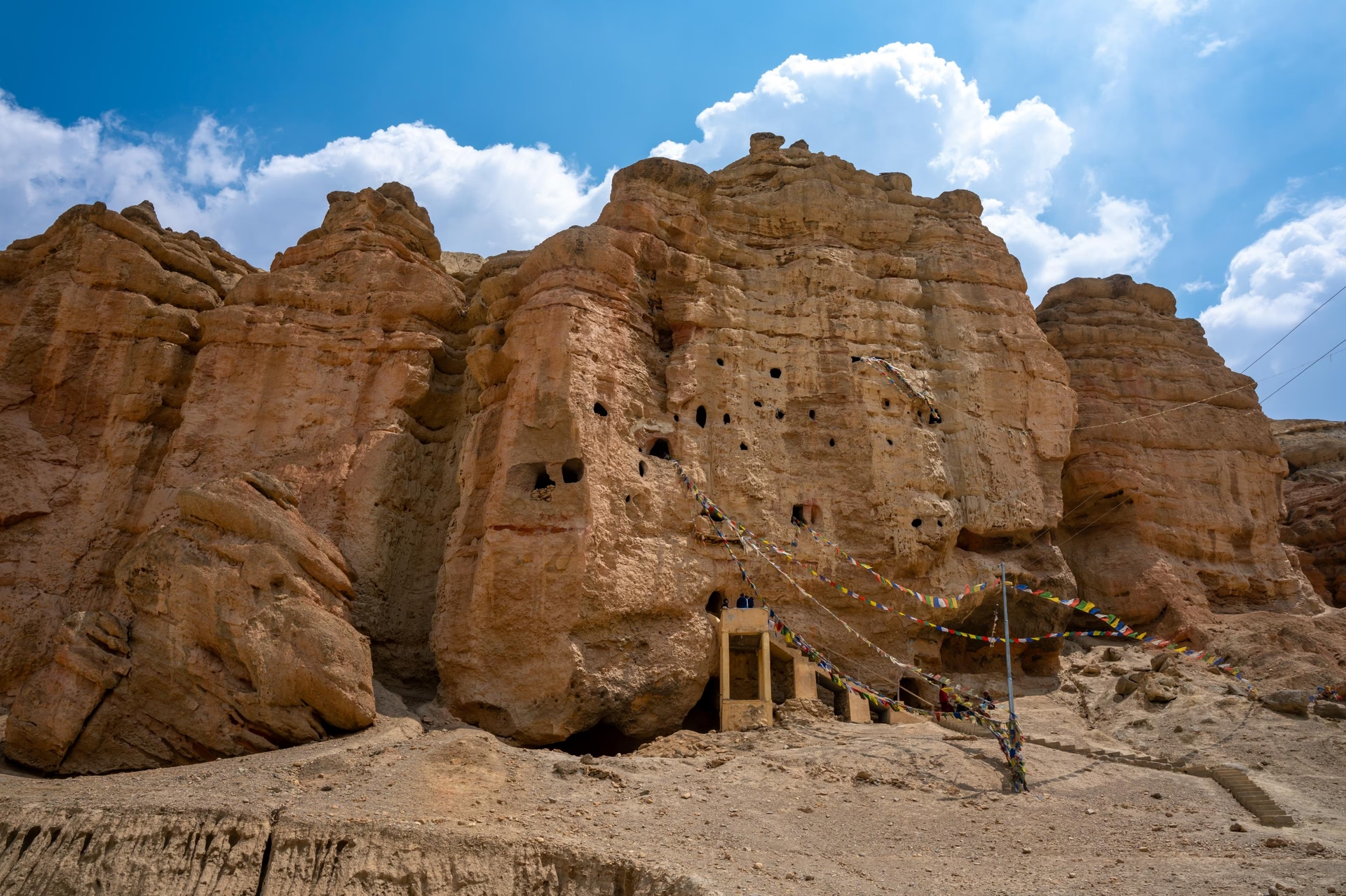
The Chhoser caves matter because Jhong Cave has five levels and more than 40 rooms linked by ladders and tunnels, and it belongs to a network of cave dwellings and tombs that archaeologists date from about 3,000 years ago.
According to ShowCaves, the first caves were burial chambers, and from the 10th century people dug cave houses for refuge during frequent battles. Chhoser is reachable from Lo Manthang by a 2-hour walk or a 30-minute jeep ride, according to HopNepal. A staircase leads to Jhong Cave from the ticket counter, a walk of about 30 minutes, per The Longest Way Home.
Lo-Gurfu Gompa and Lo-Nifu Gompa nearby add a monastery visit to the same day. Bring a headlamp, because the rooms are dark and the ladders are steep.
Which Ancient Monasteries Should You Visit Near Lo Manthang?
Visit Jampa Lhakhang (early 15th century), Thubchen Gompa, and Chode Gompa inside the walls, then Namgyal Gompa at Thingkar, Garphu, and Lo Gekar (Ghar Gompa) outside them.
Jampa Lhakhang is the oldest of the walled-city temples, built in the early 15th century and known as the "God house." Thubchen is a large red Sakya prayer hall of the 15th century. Chode is a smaller monastery beside it. A British architect, John Sanday, took part in the conservation of the Thubchen paintings, according to Mountains of Travel Photos.
Lo Gekar, also called Ghar Gompa, lies on the upper return route, and tradition credits the 8th-century master Padmasambhava with its founding.
What Can You Learn From Upper Mustang's Historic Cave Paintings?
The cave paintings show 12th to 14th century Buddhist art, manuscripts, and sculptures that document the religious and daily life of early Lo.
Archaeological expeditions have recovered 12th to 14th-century Buddhist paintings, sculptures, and manuscripts from these sites. The mountaineer Pete Athans led exploration of the sky caves with scientists from 2007 to 2012. In 2010, a burial cave at Samdzong held 27 individuals in simple coffins, as reported by HoneyGuide.
Most of these caves sit high on cliffs and need technical climbing, so visitors see only open sites such as Jhong Cave and Luri Cave Monastery. Staying on the approved sites protects the paintings from looting and wear.
7. Enjoy Stunning Himalayan Views During the Upper Mustang Trek
The Himalayan views come in two forms: giant peaks on the first and last days, and quiet desert skylines in between. Set expectations accordingly, because most of the highest peaks lie behind you once you enter the rain shadow.
Which Himalayan Peaks Can You See Along the Upper Mustang Trail?
You can see Dhaulagiri I (8,167 m), Annapurna I (8,091 m), Nilgiri (7,061 m), Tilicho Peak (7,134 m), and the Damodar Himal along the trail, with Tibetan ranges to the north.
The best views of the 8,000 m peaks come on the Pokhara to Jomsom flight and the first two walking days. After Ghami the horizon opens toward the Tibetan border, where red ridges replace snow peaks.
On the flight north to Jomsom, sit on the right side of the aircraft for Annapurna and on the left for Dhaulagiri, and book the earliest departure for clear skies.
Where Can You Find the Best Mountain Viewpoints in Upper Mustang?
The best viewpoints are Samar (3,620 m) for Nilgiri and Annapurna, Nyi La (4,010 m) for the view back down the valley, and Lo La (3,950 m) for the first look at Lo Manthang.
According to TourRadar's route description, Samar offers great views of Nilgiri and Annapurna on the descent. Nyi La is the highest pass on the standard route. Lo La rewards the walk from Charang with the first view of the walled capital across the plain.
In Lo Manthang, climb to a rooftop terrace at sunset, with permission from the lodge owner. Day 8, the rest day, is the time to use it.
How Can You Capture the Best Landscape Photography During the Upper Mustang Trek?
Shoot at the start and end of the day when low sun deepens the red cliffs, use a 24 to 70 mm lens for villages and a 70 to 200 mm lens for cliffs, and protect equipment from dust.
A polarizing filter deepens the blue sky over the red rock. Keep spare batteries inside your jacket, because cold drains them quickly, and wipe the lens often because dust is constant.
Drones need a separate permit in the Annapurna Conservation Area, according to Heaven Himalaya's permit guide. Ask people before you photograph them, and never photograph inside temples. At Tiji, follow the marshals' instructions.
8. Discover Rare Plants and Wildlife in Upper Mustang
Upper Mustang lies inside the 7,629 km² Annapurna Conservation Area, managed by the National Trust for Nature Conservation. The area holds trans-Himalayan wildlife that is hard to find elsewhere in Nepal.
Which Plants Survive in Upper Mustang's Dry Himalayan Environment?
Hardy desert shrubs, juniper, and irrigated crops of barley, buckwheat, and potatoes survive in Upper Mustang, and the region is known for medicinal and aromatic plants.
According to the Rufford Foundation project report, Mustang is recognized as a region of medicinal and aromatic plants. Tibetan amchi doctors use many of them. Villages rely on channels that bring glacial meltwater, and poplar and willow groves grow only beside those channels.
Do not pick plants or burn juniper. The slopes recover slowly, and locals collect juniper for ritual incense.
What Wildlife Can You Spot in the Upper Mustang Region?
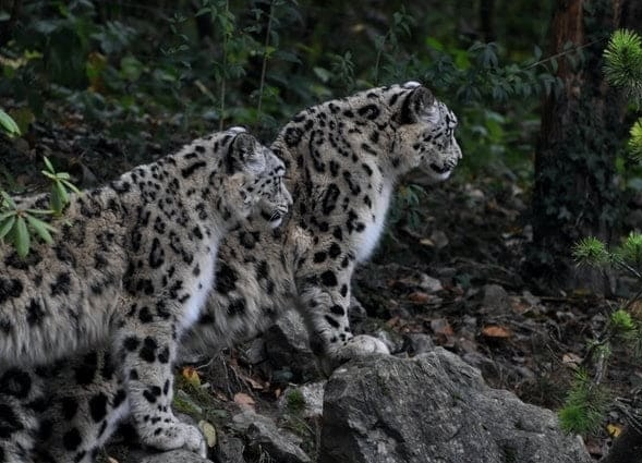
You can spot blue sheep, marmots, Himalayan wolves, and, with luck and patience, snow leopards, and the best sightings come in the early morning.
According to a Massey University thesis on human-wildlife conflict, blue sheep make up 63% of the snow leopard diet in the area, and Upper Mustang's blue sheep density of 0.86 per km² is the lowest recorded in Nepal. The same study estimates the prey base can support about 19 snow leopards. A study in the Journal of Threatened Taxa confirmed at least three adult snow leopards on camera traps in Mustang.
The Himalayan wolf has recolonized the area, according to a Rufford Foundation report. Snow leopard sightings are rare, so scan the cliffs with binoculars at dawn.
How Can Trekkers Respect Wildlife and Protect the Fragile Ecosystem?
Trekkers protect the ecosystem by staying on trails, keeping distance from animals, carrying out all waste, using refillable water bottles, and choosing lodges that cook with kerosene or solar power instead of wood.
Local people tolerate snow leopards because of Buddhist values, according to the Journal of Threatened Taxa. The tolerance has limits. According to Onlinekhabar, 13 households in Mustang district lost 65 domestic animals to snow leopards in fiscal year 2079/80 BS. Buy local products and support lodges that run community conservation programs.
Bring a water filter and skip plastic bottles. The region has no waste collection system, so everything you carry in leaves with you.
9. Follow the Historic Salt Trade Route in Upper Mustang
The Tibet to Nepal salt trade route passed through Upper Mustang for centuries, and the Kali Gandaki valley carried most of the traffic. You walk the route when you walk the trek.
Why Was the Kali Gandaki Valley Important to the Himalayan Salt Trade?
The Kali Gandaki valley mattered because Tibet had salt and little rice while southern Nepal had rice and little salt, and the river cut the only low pass through the Himalaya between them.
This regional imbalance made the Kali Gandaki gorge a vital focal point for the historic Himalayan salt trade. Villages such as Dana and Tukuche were stops. Between 1400 and 1600, according to PBS NOVA, Tibetans traveled along the river to India to trade salt for rice.
That period is Mustang's golden age. The wealth from taxing and escorting caravans paid for the temples and palaces you visit today.
How Did Ancient Trade Connect Mustang With Tibet and Nepal?
Mustang's Lowa traders carried Tibetan salt south to Thak Khola, bartered it with the Thakalis, who carried it onward to Pokhara and Kathmandu, and returned north with grain.
According to the Nepali Times, historian Baburam Acharya recorded that merchants bartered rock salt from Tibet for grain from southern Nepal. Nepal and Tibet signed a treaty in 1856 to resume cross-border trade. After 1959, border controls tightened and the trade declined, and Indian salt gradually replaced Tibetan rock salt.
The end of the trade also ended the yak and sheep caravans, along with the skills and family links that depended on them.
What Cultural and Historical Landmarks Remain Along the Old Trade Routes of Upper Mustang?
The landmarks include Kagbeni, the long mani wall at Ghami, Tangbe's chortens, Tsarang's fort, Lo Manthang's palace, and the Kora La border pass, where a new road now links Nepal and Tibet.
Muktinath, a temple complex described by Western Sydney University researchers as 2,000 years old, anchors the pilgrim side of the route.
According to Ekantipur, the 435 km Kali Gandaki Corridor road reaches Korola Naka and connects to China National Highway 219, so modern trade now moves along the old path. Trail variants still keep trekkers on the historic route for much of the walk.
10. Choose an Upper Mustang Trek That Fits Your Fitness Level
Upper Mustang is a moderate trek with limited technical demand. Its difficulty comes from altitude and wind, not from steep climbs, which opens the route to many first-time Himalayan trekkers.
How Difficult Is the Upper Mustang Trek for Beginners?
The Upper Mustang trek is moderate in difficulty, suitable for fit beginners who train for 8 to 12 weeks, because the trail has no technical sections but stays above 3,000 m for most of the route.
Daily walks run 4 to 7 hours on well-defined trails, and jeep and horse options exist for the harder stretches. Beginners succeed when they accept a slow pace and a rest day at Lo Manthang. First-time trekkers underestimate wind more than altitude.
What Daily Walking Distance and Altitude Should You Expect on Upper Mustang Trek?
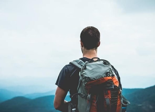
Expect 4 to 7 hours of walking per day, 10 to 20 km on the longest days, sleeping altitudes between 2,720 and 3,840 m, and passes at Nyi La (4,010 m) and Lo La (3,950 m).
The longest days are Chele to Syangboche and Lo Manthang to Dhakmar, at 6 to 7 hours each. Distance figures vary by route variant, so judge by hours instead. Sleeping altitudes stay below 4,000 m, which lowers the risk of severe altitude illness compared with higher routes.
What Training and Equipment Do You Need Before the Upper Mustang Trek?
Train 8 to 12 weeks with cardio and loaded hikes, and pack layered clothing, broken-in boots, trekking poles, sun protection, and a down jacket.
Follow this training sequence:
Walk 3 to 4 times a week, building to 5 to 6 hours with a 6 to 8 kg pack
Climb stairs or hills twice a week to build leg strength
Add one long weekend hike in the final month
Practice a steady pace at which you can speak in full sentences
Pack these items:
Boots, trekking poles, and gaiters for scree and dust
A windproof shell, fleece, and down jacket
SPF 50 sunscreen, sunglasses, and a wide-brimmed hat
A buff, a headlamp, and a water filter
Nepali rupees in cash, and travel insurance that covers helicopter evacuation above 4,000 m
Do You Need Special Permits and a Licensed Trekking Guide for Upper Mustang?
Yes. Foreigners need a Restricted Area Permit (US$500 per person for the first 10 days, plus US$50 for each additional day), an Annapurna Conservation Area Permit at NPR 3,000, and a licensed guide arranged through a registered trekking agency.
The Annapurna Conservation Area Permit costs NPR 3,000 for non-SAARC foreigners, and it costs double when issued at a check-post, according to Heaven Himalaya's permit guide. The Restricted Area Permit replaces the TIMS card for the restricted zone but does not replace the conservation permit.
The Department of Immigration issues the restricted permit in Kathmandu, and independent trekking is not permitted. The Department of Immigration strictly enforces a minimum group size of two trekkers. Independent or solo trekking is not permitted, and all travelers must be accompanied by a licensed guide from a registered trekking agency. Your agency confirms the current requirement at booking, so ask for it in writing.
How Can Heaven Himalaya Help You Experience the Upper Mustang Trek?
Heaven Himalaya handles permit applications, licensed guides, Pokhara to Jomsom flights or jeeps, lodge bookings, and an itinerary built around acclimatization, so you focus on the walk.
We apply for the Restricted Area Permit and the conservation permit before you arrive, arrange the guide and porters, and book Lo Manthang rooms in advance, which matters most in festival weeks. We also build in a weather buffer for flights and brief you on altitude symptoms on day 1.
When comparing operators, ask three questions: how many nights are spent in Lo Manthang, where the itinerary sleeps after Nyi La, and what happens if the Jomsom flight is canceled.
Next step: Send us your dates and group size, and we will outline the permit cost and the route options that fit your calendar.
Can Heaven Himalaya Customize an Upper Mustang Trek to Match Your Interests and Fitness Level?
Yes. Heaven Himalaya customizes length, transport, rest days, festival timing, and focus, whether you want photography, culture, wildlife, or a slow acclimatized walk.
Culture-focused travelers get extra time in Lo Manthang and the monasteries. Photographers get sunrise and sunset stops at Dhakmar and the Charang Chu canyon. Less experienced trekkers get a jeep section, a slower pace, and extra rest days. Tell us your fitness level honestly, because a route matched to your real pace finishes better than a faster route that forces a descent.
What Are the Key Takeaways About Trekking to the Upper Mustang Region?
The 10 key takeaways are below, each tied to a reason to trek to Upper Mustang in 2026.
Kingdom of Lo: a walled capital founded in 1380, standing at 3,840 m.
Tibetan Buddhist culture: daily monastery practice and the Tiji Festival (14 to 16 May in 2026).
Landscapes: red cliffs and a rain-shadow desert with 250 to 400 mm of precipitation a year.
Seasons: spring and autumn balance weather and services, and summer works in the rain shadow.
Itinerary: 14 days on foot or 8 days by jeep, with a sleeping-altitude plan that protects acclimatization.
Monasteries and caves: Jampa, Thubchen, Chode, and the five-level Jhong Cave.
Himalayan views: Dhaulagiri, Annapurna, and Nilgiri early, desert ridges after.
Wildlife: blue sheep, Himalayan wolves, and snow leopards.
Salt trade: Tibetan salt moved south along the Kali Gandaki for centuries.
Fitness: a moderate trek for fit beginners with 8 to 12 weeks of training.
The Upper Mustang trek is highly accessible in 2026 with new road access expanding itinerary options. Keep in mind that regardless of trip length, the minimum restricted area permit fee remains US$500, so plan to spend an adequate amount of time exploring the region to maximize the value of your permit. Plan the season, confirm the permits and group-size rules, and book the Lo Manthang nights early.
Plan your Upper Mustang trek: Contact Heaven Himalaya for a route, permit cost, and season recommendation matched to your dates.